73Nature and parks · Osogovo
Kyunek Peak
Your visit at a glance
- Address
- Osogovo, above Osogovo Hut on the ridge toward Choveko
- Approximate time for the whole walking outing
- about 3 hours
- Visiting conditions
- No verified information found
- Admission
- No verified information found
The image could not load. Its caption and source remain available.

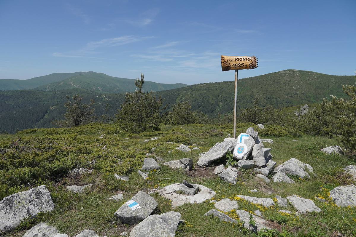
Kyunek is an Osogovo peak above Osogovo Hut, overlooking Choveko and the high ridge toward Ruen. The Osogovo Tourist Association and OpenStreetMap give 1,925 m; a guidebook and photographic labels also use 1,923 m.
Hours, admission, and directions ↓
Kyunek is close to Osogovo Hut and makes a useful separate destination for a walking trip. A cairn and sign mark the summit, while the view connects the lower high points of this part of the mountain with Choveko and the high ridge toward Ruen. Proximity to the hut does not change the mountain character of the walk.
Why the elevation varies
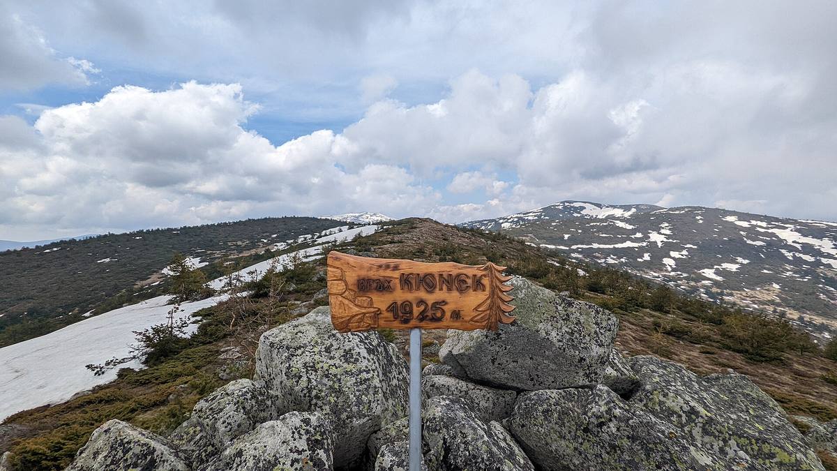
↗Evgeniy Dinchev and Petar Atanasov’s guide gives 1,923 m. The Osogovo Tourist Association gives 1,925 m in its account of an ascent on July 12, 2022; the OpenStreetMap point and the sign in the selected photographs use the same number. The practical information here follows 1,925 m.
The photographer of some images uses a height of 1,922.8 m, rounded to 1,923 m. This is a difference between sources for the summit. Separate lower points on neighboring domes should not be treated as alternative elevations of the highest point.
The rocky summit and the view
↗Dinchev and Atanasov identify Kyunek among places where denudation has exposed Osogovo’s granite. Denudation includes the processes that break down and remove surface material. The rocky summit is also clear in the photographs, with large blocks around the summit sign.
The direction toward Choveko leads farther into the mountain; more distant peaks include Tsarni Kamak, Shapka, and Ruen. The snowy summit photograph illustrates how different the same ground appears in the colder season. A photograph alone does not assess winter safety.
From the hut and from Pamuka
↗The hut’s operator, the Osogovo Tourist Association, gives about an hour from the hut to Kyunek. Its report on the 2022 hut celebration also describes volunteers clearing and marking a route from the Pamuka locality, with a walking time of around an hour and a half to the summit.
These are two different approaches. The clearance account is dated and does not establish the current condition of every section. Check your chosen start and waymarks locally. For the hut approach, return, and time at the summit, allow around three hours.
Continuing toward Choveko
↗Kyunek is the first summit on TripsJournal’s described winter circuit toward Choveko and Prevala. The complete route is approximately 12 km and six hours, substantially longer than a separate Kyunek visit. The detailed account relates the choice of path to snow conditions on the day.
Hypothesis or unconfirmed claim Decide beforehand whether to return from the summit or continue along the ridge. Bring water and a map, watch the weather, and leave time for the descent. Follow the signs around the ski slopes. No published visitor schedule or admission tariff was found for the summit, and vehicle access to the top has not been confirmed.
Photos and related images
The image could not load. Its caption and source remain available.

Sources
(5)
A date may refer to construction, renewal, or another stated stage. Legends are accounts recorded in sources, rather than established events. Bibliography links help locate the named author; no automatic reference is added where the match is ambiguous.
- Евгений Динчев, Петър Атанасов. Високите планини на Република Македония, глава „Осогово“, 1998, онлайн текстOnline source · Bulgarian · macedonia.kroraina.com
Source address
https://macedonia.kroraina.com/vpm/vpm_10.htm
If a link does not open, use its title, author, and address to search, or consult another listed source.
- OpenStreetMap: node/10303988588Map record · Language not specified · openstreetmap.org
Source address
https://www.openstreetmap.org/node/10303988588
If a link does not open, use its title, author, and address to search, or consult another listed source.
- Материална база: хижа „Осогово“, ТД „Осогово“, маршрут до КюнекOnline source · Bulgarian · td-osogovo.org
Source address
https://td-osogovo.org/index.php/home/baza
If a link does not open, use its title, author, and address to search, or consult another listed source.
- Празник на хижа „Осогово“, ТД „Осогово“, изкачване на 12.07.2022 и маршрут от ПамукаOnline source · Bulgarian · td-osogovo.org
Source address
https://td-osogovo.org/index.php/moments/latest-news/564-празник-на-хижа-осогово-2
If a link does not open, use its title, author, and address to search, or consult another listed source.
- Хижа Осогово - връх Кюнек - връх Човеко - заслон Превала, зимен маршрут, TripsJournalOnline source · Bulgarian · tripsjournal.com
Source address
https://tripsjournal.com/marshrut/hija-osogovo-vrah-kyunek-vrah-choveko-zaslon-prevala-zimen
If a link does not open, use its title, author, and address to search, or consult another listed source.