71Nature and parks · Osogovo
Kulitsite Peak
Your visit at a glance
- Address
- Osogovo, on the ridge south of Choveko toward Tsarni Kamak
- Approximate time for the whole walking outing
- about 4 hours
- Visiting conditions
- No verified information found
- Admission
- No verified information found
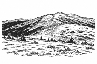
Kulitsite is a lower summit on Osogovo’s ridge between Choveko and Tsarni Kamak. Dinchev and Atanasov’s guide and OpenStreetMap give 1,862 m; the name refers to a separate site from Kulin Kamak near Kyunek.
Hours, admission, and directions ↓
Kulitsite forms part of the ridge connection between Choveko and the higher peaks toward Ruen. It is lower than those peaks and less often a hike’s final destination. Its position nevertheless helps explain the different walking routes through this part of Osogovo.
Which summit the name identifies
↗In Evgeniy Dinchev and Petar Atanasov’s guide, the ridge descends almost south from Choveka to Kulitsite, then turns southwest toward Tsarni Kamak and Shapka. They give an elevation of 1,862 m. The corresponding OpenStreetMap point records the same figure.
An older GPS list, updated in 2008, gives 1,872 m for Kulitsite. Its coordinates are close to the present mapped point. The disagreement remains a difference between sources, without a new survey here to resolve it. The practical information follows the guide and map’s figure of 1,862 m.
Kulin Kamak is a different name and site in the Kyunek area. Descriptions and photographs of it do not independently establish Kulitsite’s appearance or elevation. For navigation, use the name together with the mapped point and neighboring summits.
The ridge and the route
↗Kulitsite links two parts of the mountain: Choveko and Prevala on one side, and Tsarni Kamak and Shapka on the other. Routes toward Ruen may use tracks across the slopes without crossing every named summit.
Before setting out, review the entire route rather than only its final destination. If you want to visit Kulitsite, establish whether your chosen track reaches the summit point. The coordinates identify the peak; they do not indicate a convenient vehicle approach.
A documented conservation episode
↗The Association of Parks in Bulgaria’s 2017 report includes Kulitsite, Shapka, and Tsarni Kamak among ridge pastures offered in a national auction of state land. The organization describes gathering data, analysis, and a campaign to exclude protected land from sale.
The reported removal of more than 40,000 decares from the auction was an overall result covering different places across Bulgaria. That figure is not Kulitsite’s area. The report does not establish the current ownership of every parcel around the peak, but it shows why the open pastures became a matter of public concern.
Visiting
↗For a hike from Osogovo Hut and back, allow roughly four hours, after establishing the particular route through the Prevala area. This is a planning allowance to adjust for your pace, weather, and trail conditions.
Bring a map and water, and do not assume every earth track is passable or accessible by vehicle. Snow requires a separate route assessment. No published visitor schedule or admission tariff was found.
Sources
(4)
A date may refer to construction, renewal, or another stated stage. Legends are accounts recorded in sources, rather than established events. Bibliography links help locate the named author; no automatic reference is added where the match is ambiguous.
- Евгений Динчев, Петър Атанасов. Високите планини на Република Македония, глава „Осогово“, 1998, онлайн текстOnline source · Bulgarian · macedonia.kroraina.com
Source address
https://macedonia.kroraina.com/vpm/vpm_10.htm
If a link does not open, use its title, author, and address to search, or consult another listed source.
- OpenStreetMap: node/11152714806Map record · Language not specified · openstreetmap.org
Source address
https://www.openstreetmap.org/node/11152714806
If a link does not open, use its title, author, and address to search, or consult another listed source.
- GPS Осогово, BGMountains, списък, допълнен на 16.03.2008Online source · Bulgarian · bgmountains.bglink.net
Source address
https://www.bgmountains.bglink.net/GPS-osogovo.html
If a link does not open, use its title, author, and address to search, or consult another listed source.
- Асоциация на парковете в България. Отчет за дейността през 2017 г., т. 8, с. 6PDF document · Bulgarian · parks.bg
Source address
https://parks.bg/wp-content/uploads/2015/09/otchet-za-deinost-na-APB-za-2017.pdf
If a link does not open, use its title, author, and address to search, or consult another listed source.