72Nature and parks · Osogovo
Choveko Peak
Your visit at a glance
- Address
- Osogovo, west of Kyunek, above the Prevala area
- Approximate time for the whole walking outing
- about 5 hours
- Visiting conditions
- No verified information found
- Admission
- No verified information found
The image could not load. Its caption and source remain available.

Choveko, also called Choveka, rises to 2,047 m between Kyunek and the Prevala area in Osogovo. It is an important ridge junction and can be a separate hiking destination from Osogovo Hut.
Hours, admission, and directions ↓
Choveko is Kyunek’s higher neighbor on the ridge leading into Osogovo. From here, you can trace the directions toward Prevala, Kulitsite, and the higher summits on the approach to Ruen. Sources use both Choveko and Choveka; the mapped point used here identifies the same Osogovo peak.
A junction of several directions
↗Evgeniy Dinchev and Petar Atanasov describe Choveka as one of the mountain’s important ridge junctions and give an elevation of 2,047 m. OpenStreetMap records the same figure. The guide identifies its older name as Beg Bunar, associated with the nearby fountain; that name also applies to a long section of the ridge described.
From Kyunek, the ridge leads west toward Choveko, then continues almost south toward Kulitsite. Routes through the Prevala area also use the slopes between these points. The peak can therefore be a destination in its own right or part of a longer hike. In either case, establish whether your route reaches its summit.
A rare yarrow in the high ground
↗Boris Assyov and Vladimir Vladimirov identify Choveka and Mali Ruen as localities of Achillea chrysocoma in Bulgaria’s Red Data Book, published by the Bulgarian Academy of Sciences and the Ministry of Environment and Water. The species is an endangered Balkan endemic; the Bulgarian localities described lie above 1,900 m.
This establishes a botanical connection with a specifically named site. The account is not a current map of individual plants, however, and does not guarantee sightings on every visit. Leave flowers in place and avoid trampling vegetation away from the established approach.
Through Kyunek and Prevala
↗The field account on TripsJournal follows a winter circuit from Osogovo Hut through Kyunek, Choveko, and Prevala Shelter, then back to the hut. It records approximately 12 km and six hours for that particular hike. The author emphasizes that the route was chosen for the snow conditions on the day.
The account describes a stone cairn and wooden pole on Choveko’s summit. The shelter area and Beg Bunar can be seen from it. The descent is described as lacking a clear path, while the return section toward the hut involves avalanche risk depending on conditions. The published track should not be treated as a universal winter route.
Views and planning
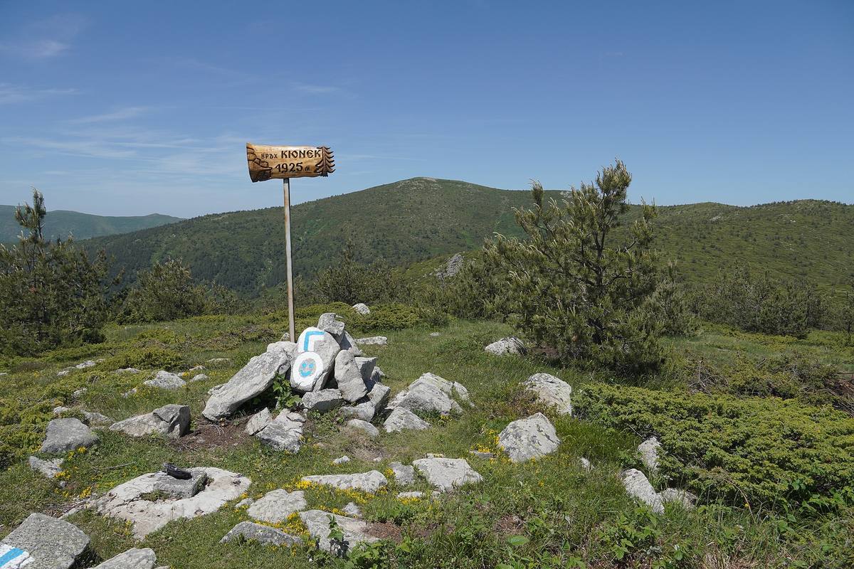
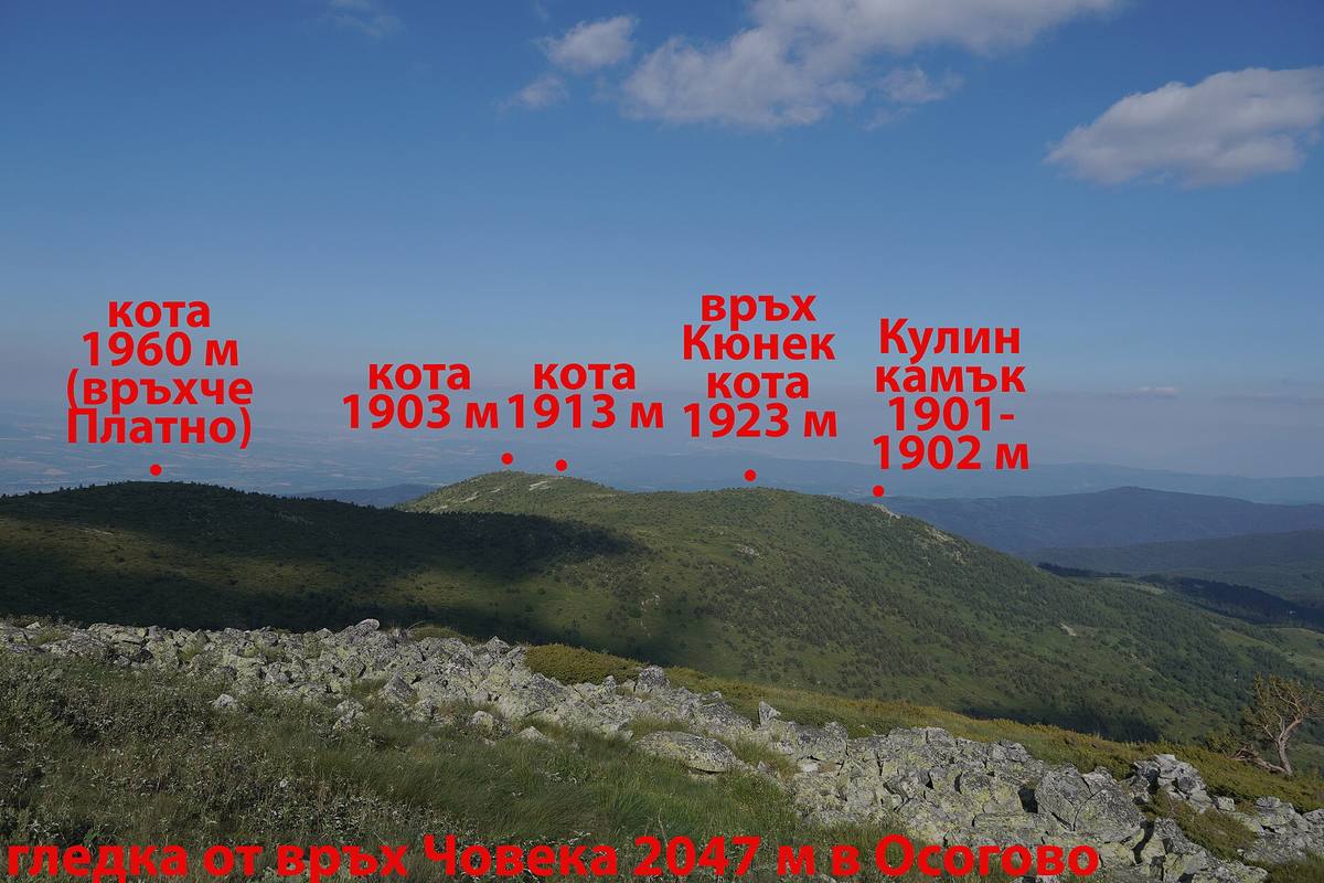
↗The first photograph shows Choveko in the distance, viewed from Kyunek. The second looks back from Choveko toward the lower high points and Kyunek, with the photographer’s original labels. Together, they illustrate the relationship between the summits from opposite directions.
For a separate visit from Osogovo Hut and back, allow around five hours depending on your route and pace. Plan the full circuit separately. Check the forecast and current trail conditions, and bring a map and water. Snow requires an assessment of the route, including the return. No published visitor schedule or admission tariff was found for the peak.
Photos and related images
The image could not load. Its caption and source remain available.

Sources
(4)
A date may refer to construction, renewal, or another stated stage. Legends are accounts recorded in sources, rather than established events. Bibliography links help locate the named author; no automatic reference is added where the match is ambiguous.
- Евгений Динчев, Петър Атанасов. Високите планини на Република Македония, глава „Осогово“, 1998, онлайн текстOnline source · Bulgarian · macedonia.kroraina.com
Source address
https://macedonia.kroraina.com/vpm/vpm_10.htm
If a link does not open, use its title, author, and address to search, or consult another listed source.
- OpenStreetMap: node/6984655385Map record · Language not specified · openstreetmap.org
Source address
https://www.openstreetmap.org/node/6984655385
If a link does not open, use its title, author, and address to search, or consult another listed source.
- Борис Асьов, Владимир Владимиров. Беловлакнест равнец (Achillea chrysocoma), Червена книга на България, БАН и МОСВ, онлайн изданиеOnline source · Bulgarian · e-ecodb.bas.bg
Source address
http://e-ecodb.bas.bg/rdb/bg/vol1/Achchrys.html
If a link does not open, use its title, author, and address to search, or consult another listed source.
- Хижа Осогово - връх Кюнек - връх Човеко - заслон Превала, зимен маршрут, TripsJournalOnline source · Bulgarian · tripsjournal.com
Source address
https://tripsjournal.com/marshrut/hija-osogovo-vrah-kyunek-vrah-choveko-zaslon-prevala-zimen
If a link does not open, use its title, author, and address to search, or consult another listed source.