12Nature and parks · Zemen Gorge
Polska Skakavitsa Waterfall
Your visit at a glance
- Address
- The northeastern edge of the village of Polska Skakavitsa, in the Zemen Gorge of the Struma, Kyustendil Municipality
- Approximate time for the whole walking outing
- about 2 hours
- Visiting conditions
- No verified information found
- Admission
- No verified information found
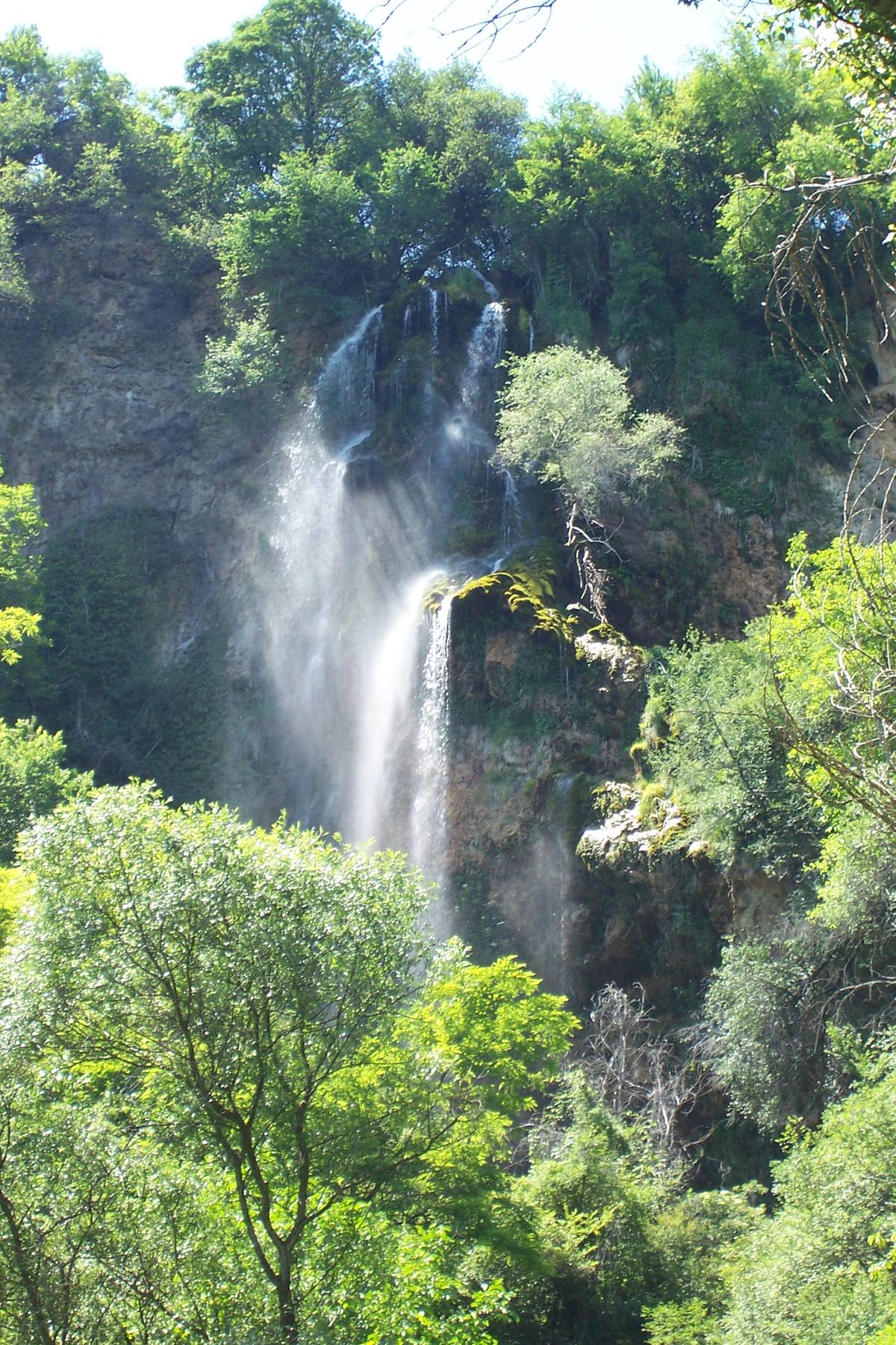
The image could not load. Its caption and source remain available.

A waterfall about 53 m high in the Zemen Gorge of the Struma, beside the almost empty village of Polska Skakavitsa. Its water is so rich in lime that it builds up tufa on the rock, and the fall keeps changing shape. The Czech historian Konstantin Jireček wrote in 1888 that the view has “few equals in the wilds of the Balkan Peninsula.”
Hours, admission, and directions ↓
A limestone cliff above the Struma, a thin curtain of water falling over it, and around it moss and tufa deposited by the water. All around is the Zemen Gorge, and up on the rim is the village the waterfall gave its name to.
How high is it?
↗Sources disagree. The academic overview of Bulgaria’s geological heritage (1996), OpenStreetMap, and a 2026 study published by Springer give 53 m. Wikipedia and the site geograf.bg say 50 m. Older geographic sources and some websites give 70 m.
70 m is also the height of another, better-known waterfall, Skakavitsa in the Rila Mountains, which is probably where the confusion comes from. We follow the scientific source: about 53 m.
A brochure published under a project of the Kyustendil and Konče municipalities, in the Interreg-IPA Bulgaria-Macedonia program, gives both figures: from the highest point, where the waterfall begins, down to the level of the Struma the drop is 70 m, and the main fall is 53 m. So the 70 m may simply be the total drop. The brochure calls the stream Golemi (Shiroki) Dol.
In its upper part the stream forms several karst steps, after which the water falls freely. Visitors describe an upper and a lower level, and a small path leads behind the water curtain.
The waterfall that grows
↗The rock is tufa (travertine), “a porous limestone rock formed by the calcification of plants.” The water comes from nearby karst springs and is heavily calcareous. As it falls, the calcium carbonate is deposited again along the edge of the rock step. New layers build up while gravity and erosion break off the old ones, so the waterfall’s shape changes fairly quickly.
Geologists describe the waterfall as “Quaternary travertine over Paleozoic and Triassic limestones.” Wikipedia goes further: unlike most waterfalls, which retreat through erosion, this one “rises every year.” It adds cautiously: “It is claimed that this is the only such waterfall in Bulgaria.” We found no scientific confirmation of that last part.
Jireček at the waterfall
↗In the 1880s Konstantin Jireček rode down the Zemen Gorge. Suddenly a limestone wall more than 100 m high appeared before him. On its rim stood clay houses with red roofs, “like swallows’ nests,” and from them “two thin, silver-foamed waterfalls” fell toward the Struma. Below lay a grove of poplars, apple trees, and plum trees, hiding a small mill. [9]
Jireček called it “a beautiful panorama that has few equals in the wilds of the Balkan Peninsula.” He noted the tufa too: “from the dissolving of the limestone, a fine travertine forms around the waterfall.” It is the earliest scientific description of the place we have found.
The waterfall’s village
↗Jireček also explained the name: in Bulgarian, skok commonly means waterfall. Polska (“of the field”) sets the village apart from Kamenichka Skakavitsa, west of Kyustendil.
- 14th century: a village called Skakavitsa is mentioned in medieval charters, though their dates and monasteries differ.
- 1570-1572: Ottoman tax registers list 13 Muslim and 49 Christian households.
- 1576-1577: a livestock-tax register records it as “Iskakaviche.”
- 1866: the village had 44 houses and 308 people.
- 1892: master Georgi Manchov built the church of St. Dimitar above the waterfall.
- 1903: a school was built.
- 1942: a chitalishte, a village reading room and cultural center, was founded.
- 1945: the local credit cooperative was named Vodopad, “Waterfall.”
- 1946: the population peaked at 779.
- End of 2025: 23 people lived in Polska Skakavitsa.
The Zemen Gorge
↗The waterfall lies in the Zemen Gorge, a deep defile of the Struma about 22 km long, between the Zemenska Mountains to the west and the Risha ridge of the Konyavska Mountains to the east. The gorge is cut into Mesozoic sandstone, limestone, and dolomite, with caves, karst springs, and rock formations. Below the waterfall the Struma, “unable to go forward,” turns south into rocky ravines.
The gorge also lies on one of the main flyways for migrating birds to Africa, the Via Aristotelis. Upstream are the Zemen fortress and the Zemen rocks. About 3.5 km northeast of the village church is Kaleto, a late Roman and medieval fortress enclosed by the Struma on three sides and excavated by Dora Dimitrova.
The Red Data Book of Bulgaria (the online edition of the Bulgarian Academy of Sciences and the Ministry of Environment, 2011) shows how valuable the gorge is:
- Centaurea finazzeri, a critically endangered Balkan endemic, has its only Bulgarian population here, between Polska Skakavitsa and Garbino, at 480-510 m: about 300 plants on about 2 km². The book names the railway tunnels dug through the site as a threat (entry by Svetlana Bancheva, Dimitar Dimitrov, and Aleksandra Yaprakova).
- The western rock nuthatch, a vulnerable species with about 600 pairs in Bulgaria, reaches north as far as the Zemen Gorge.
- Barbatula bureschi, a vulnerable small fish found only in the Struma and Mesta, was first described from the Struma at Zemen station.
- Hop-hornbeam woods, a Tertiary relic, are among the vulnerable habitats and also grow in the Zemen defile.
The groundwater of the gorge is described by Lazar Berov in a guide for a field excursion of the Bulgarian Geological Society (2018). In the Konyavska and Zemenska Mountains the water collects mainly in Middle and Upper Triassic limestone and dolomite, about 350-400 m thick in all. Rain soaks into it quickly, so little water runs on the surface, and the larger springs are at Konyavo (about 60 liters per second) and Razhdavitsa (30-50).
The legend of Dragana
↗Tradition or legend To the right of the waterfall, as you come from the Skakavitsa halt, stands a rock said to guard it: Dragana’s Rock. The legend says that the beautiful girl Dragana, pursued by Turks, cried out, “I won’t go with a Turk, I won’t become a Turkish wife, I won’t change my faith, I am Bulgarian,” and leaped from the rock. The story is recorded in only one popular source.
The fight for the waterfall
↗In 2005-2006 a dam with a small hydropower plant was proposed near Razhdavitsa, with a 20 m wall and a 176-hectare reservoir. In 2008-2009 a similar project came back. Opponents warned that it would flood the terrace below the waterfall and cut off access to it. In January 2009 people in Kyustendil started a petition; about 1,000 paper and 2,500 online signatures were reported. We couldn’t find out exactly how the story ended.
The waterfall has been a natural landmark since July 2, 1968.
Photos and related images
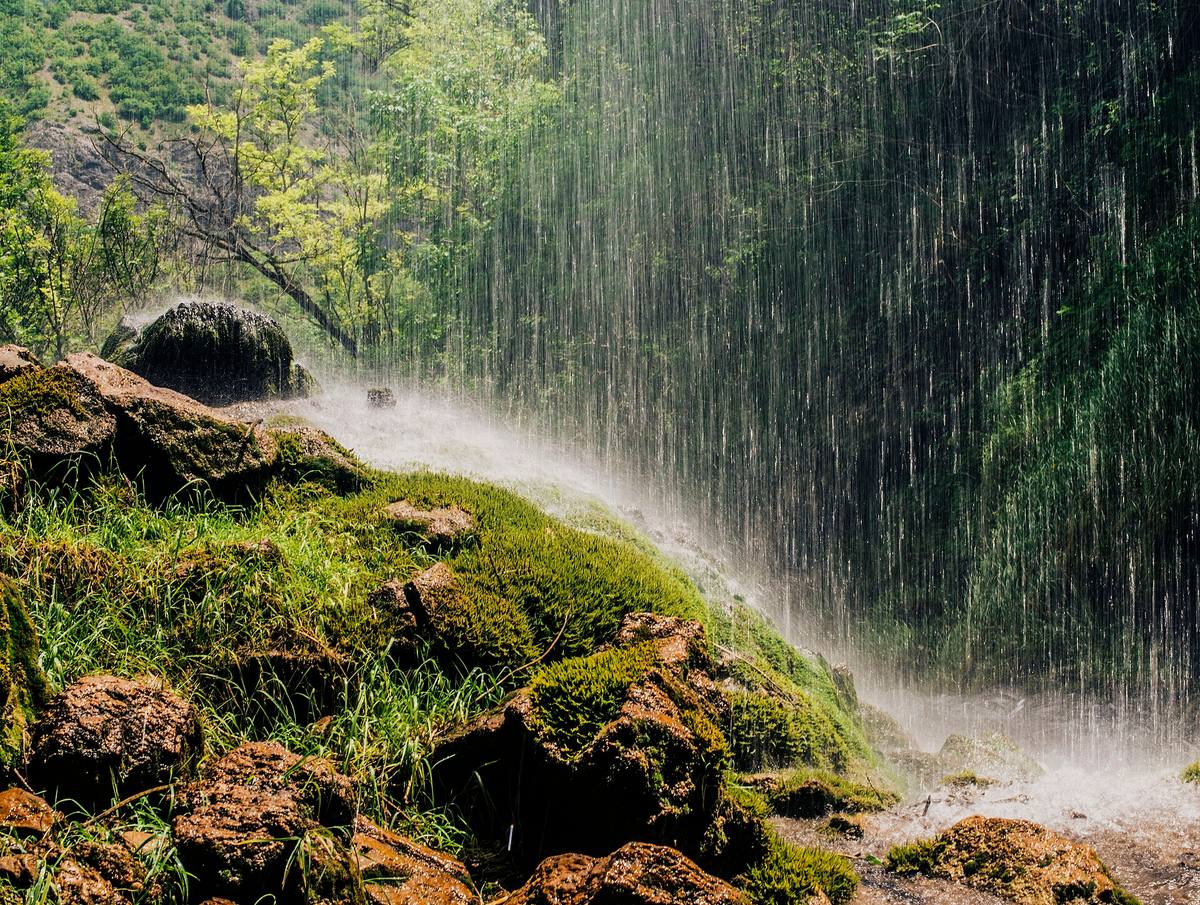
The image could not load. Its caption and source remain available.

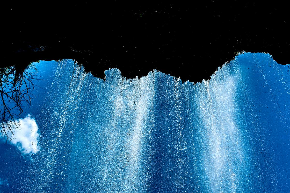
The image could not load. Its caption and source remain available.

Sources
(18)
A date may refer to construction, renewal, or another stated stage. Legends are accounts recorded in sources, rather than established events. Bibliography links help locate the named author; no automatic reference is added where the match is ambiguous.
- Z. Iliev, T. Todorov, I. Zagorchev, E. Djourova. The geological heritage of Bulgaria (overview), Geologica Balcanica 26(1), 1996PDF document · Language not specified · geologica-balcanica.eu
Source address
http://www.geologica-balcanica.eu/sites/default/files/articles/GB%281996%29_26_1_pp.63-68%20%28Iliev%20et%20al%29.pdf
If a link does not open, use its title, author, and address to search, or consult another listed source.
- Червена книга на Република България, т. 1, БАН и МОСВ, 2011: Скална метличина (Centaurea finazzeri)Online source · Bulgarian · e-ecodb.bas.bg
Source address
http://e-ecodb.bas.bg/rdb/bg/vol1/Cenfinaz.html
If a link does not open, use its title, author, and address to search, or consult another listed source.
- Червена книга на Република България, т. 2, БАН и МОСВ, 2011: Скална зидарка (Sitta neumayer)Online source · Bulgarian · e-ecodb.bas.bg
Source address
http://e-ecodb.bas.bg/rdb/bg/vol2/Sineumay.html
If a link does not open, use its title, author, and address to search, or consult another listed source.
- Червена книга на Република България, т. 2, БАН и МОСВ, 2011: Струмски гулеш (Barbatula bureschi)Online source · Bulgarian · e-ecodb.bas.bg
Source address
http://e-ecodb.bas.bg/rdb/bg/vol2/Baburesc.html
If a link does not open, use its title, author, and address to search, or consult another listed source.
- Червена книга на Република България, т. 3, БАН и МОСВ, 2011: Гори от воден габър (Ostrya carpinifolia)Online source · Bulgarian · e-ecodb.bas.bg
Source address
http://e-ecodb.bas.bg/rdb/bg/vol3/21G1.html
If a link does not open, use its title, author, and address to search, or consult another listed source.
- Хидрогеоложки условия в района на Кюстендилската котловина (материал на Лазар Беров). Годишна геоложка екскурзия на БГД, 2018Research publication · Bulgarian · bgd.bg
Source address
https://www.bgd.bg/EXCURZII/Excursion_2018/Hydrogeology_Kyustendil.pdf
If a link does not open, use its title, author, and address to search, or consult another listed source.
- Polska Skakavitsa Waterfall. Брошура по проект CB006.1.21.164, общини Кюстендил и Конче, Interreg-IPA България-МакедонияOnline source · Bulgarian · keep.eu
Source address
https://keep.eu/api/project-attachment/15121/get_file/
If a link does not open, use its title, author, and address to search, or consult another listed source.
- P. Bozhkov. Weathering and Slope Processes in the Zemen Gorge, Landscapes and Landforms of Bulgaria, Springer, 2026Online source · Language not specified · doi.org
Source address
https://doi.org/10.1007/978-3-032-16815-3_11
If a link does not open, use its title, author, and address to search, or consult another listed source.
- Konstantin Jireček. Cesty po Bulharsku, 1888, archive.orgOnline source · Language not specified · archive.org↑1
Source address
https://archive.org/details/cestypobulharsku00jire
If a link does not open, use its title, author, and address to search, or consult another listed source.
- Екологичен мониторинг на река Драговищица, Български икономически форум, 2015PDF document · Bulgarian · dams.reki.bg
Source address
https://dams.reki.bg/uploads/Docs/Files/1452085663_1.doklad_esenen_monitoring_dragovishtitsa.pdf
If a link does not open, use its title, author, and address to search, or consult another listed source.
- Димитър Желев. Българският рай, Полска Скакавица, geograf.bg, 2015Online source · Bulgarian · geograf.bg
Source address
https://geograf.bg/bg/article/blgarskiyat-ray-polska-skakavica
If a link does not open, use its title, author, and address to search, or consult another listed source.
- Скакавишки водопад „Полска Скакавица“, Strannik.bgOnline source · Bulgarian · strannik.bg
Source address
https://strannik.bg/o/4126/skakavishki-vodopad-polska-skakavitsa/
If a link does not open, use its title, author, and address to search, or consult another listed source.
- От гара Скакавица до водопад Полска Скакавица, TripsJournalOnline source · Bulgarian · tripsjournal.com
Source address
https://tripsjournal.com/marshrut/vodopad-polska-skakavitsa
If a link does not open, use its title, author, and address to search, or consult another listed source.
- Водопадът Полска Скакавица, Кюстендилско, forthenature.orgOnline source · Bulgarian · forthenature.org
Source address
https://forthenature.org/cases/31
If a link does not open, use its title, author, and address to search, or consult another listed source.
- Полска Скакавица (водопад), УикипедияEncyclopedia article · Bulgarian · bg.wikipedia.org
Source address
https://bg.wikipedia.org/wiki/Полска_Скакавица_(водопад)
If a link does not open, use its title, author, and address to search, or consult another listed source.
- Полска Скакавица (село), УикипедияEncyclopedia article · Bulgarian · bg.wikipedia.org
Source address
https://bg.wikipedia.org/wiki/Полска_Скакавица
If a link does not open, use its title, author, and address to search, or consult another listed source.
- Земенски пролом, УикипедияEncyclopedia article · Bulgarian · bg.wikipedia.org
Source address
https://bg.wikipedia.org/wiki/Земенски_пролом
If a link does not open, use its title, author, and address to search, or consult another listed source.
- OpenStreetMap: Полска СкакавицаMap record · Bulgarian · openstreetmap.org
Source address
https://www.openstreetmap.org/node/4204798265
If a link does not open, use its title, author, and address to search, or consult another listed source.