35Nature and parks · Near Razhdavitsa
Shegava River Canyon
Your visit at a glance
- Address
- Entrance by the karst spring on the Razhdavitsa-Garbino road, Konyavska Mountain
- Approximate time for the whole walking outing
- about 3 hours
- Visiting conditions
- No verified information found
- Admission
- No verified information found
The image could not load. Its caption and source remain available.

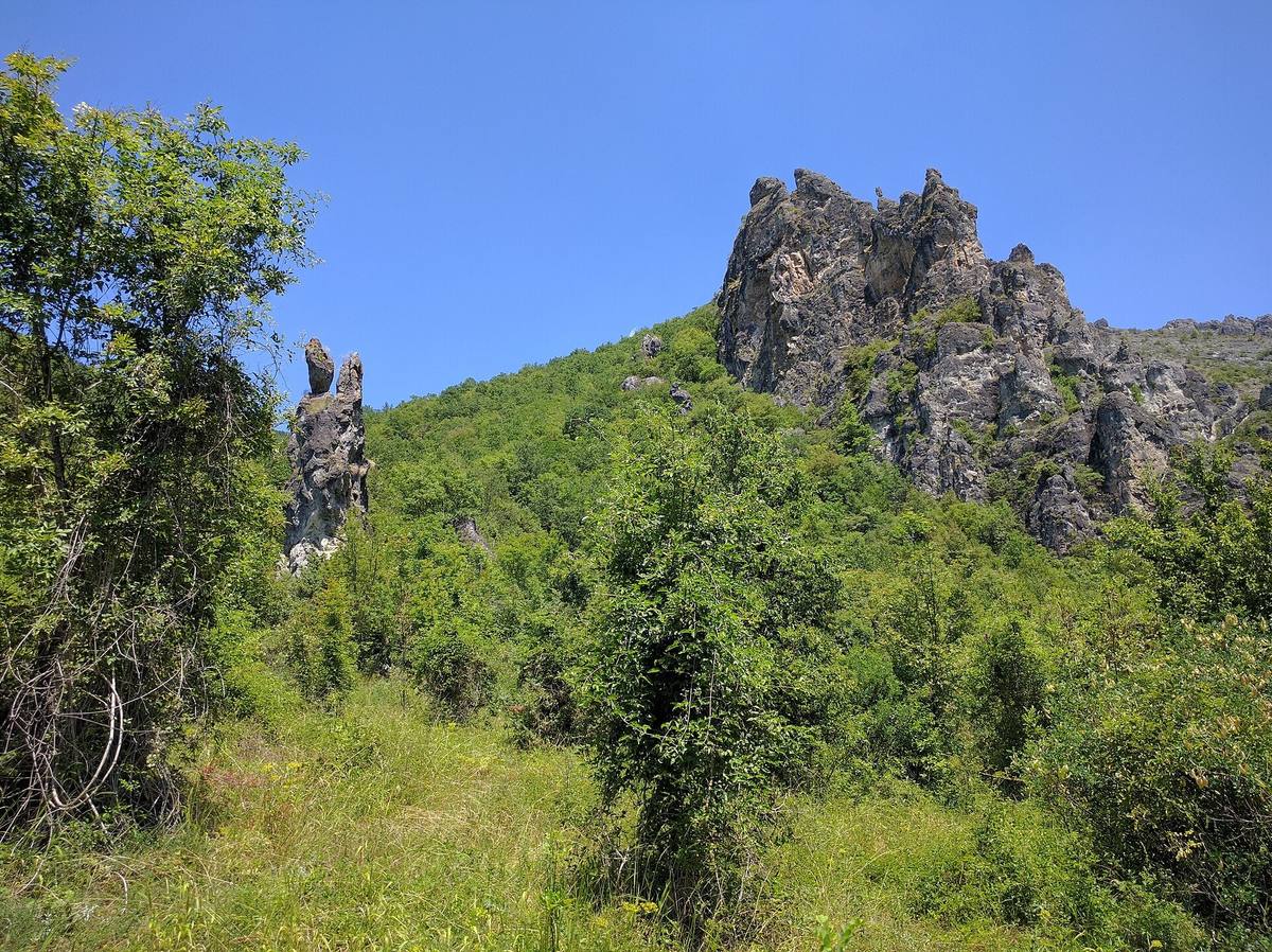
The Shegava cuts through limestone terrain in Konyavska Mountain near Razhdavitsa. The gorge contains high rock walls, isolated stone formations, and a riverbed that remains dry for much of the year.
Hours, admission, and directions ↓
The first Shegava rock formations are visible on the approach from the Razhdavitsa-Garbino road. Low vegetation, narrow passages, and rock steps separate them. This landscape changes with the movement of water: a dry bed in one season may carry a powerful flow after rain.
A canyon in Konyavska Mountain
↗Atanas Ivanov and Stanislav Todorov, identified as Sofia University students, describe the site in Geograf e-magazine, issue 8 (2023-2024). They place it in the Rish section of Konyavska Mountain, near the Struma’s exit from Zemen Gorge. The Shegava is a left tributary of the Struma. It is not part of Osogovo, although the two mountains often feature in the same travel itineraries around Kyustendil.
The authors also explain the landform’s name. In geographical terms, the deeply incised valley with narrow, steep slopes can be called a gorge. “Shegava Canyon,” however, is its established local and tourism name. Both words refer here to the same site, rather than two different places.
The river is about 10 km long. Its modest length gives little indication of the scale of the rock walls it has cut through. Ivanov and Todorov identify the bedrock as Triassic dolomites and dolomitized limestones. Both river erosion and karst processes have shaped these rocks.
Water that disappears
↗For much of the year, water sinks into the karst terrain, leaving the gorge’s bed dry. Heavy rain and melting snow produce surface flow. At the outlet, the water reappears as a karst spring, part of which has been tapped. The river then continues toward the Struma.
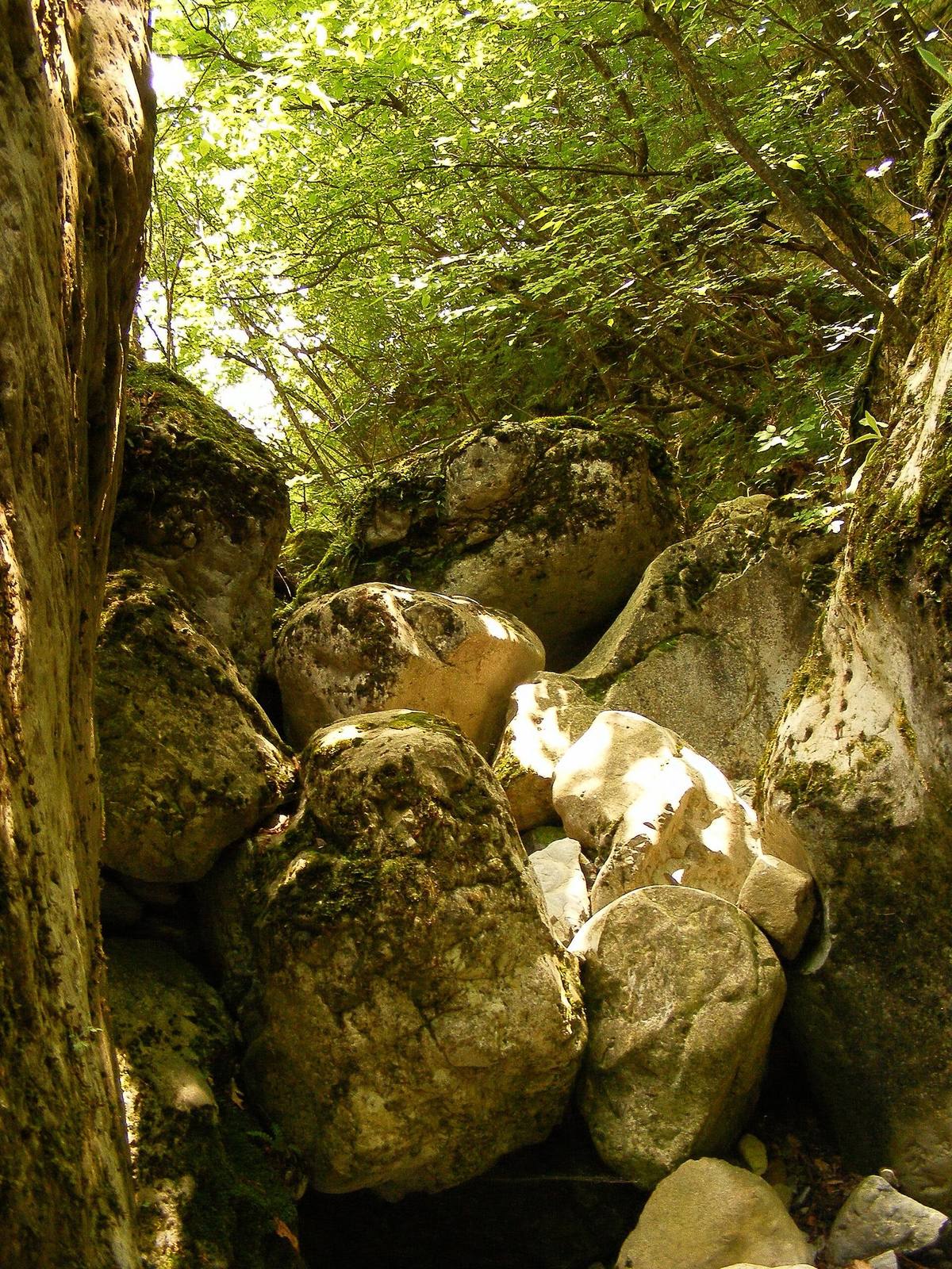
Channels and potholes on the rock steps were formed by swirling water. In the side ravine of Padalishteto, a high rock step interrupts the passage. A dry bed therefore does not mean a level, continuous walking trail. Following its upper sections may require climbing and knowledge of the terrain.
Rocks and their names
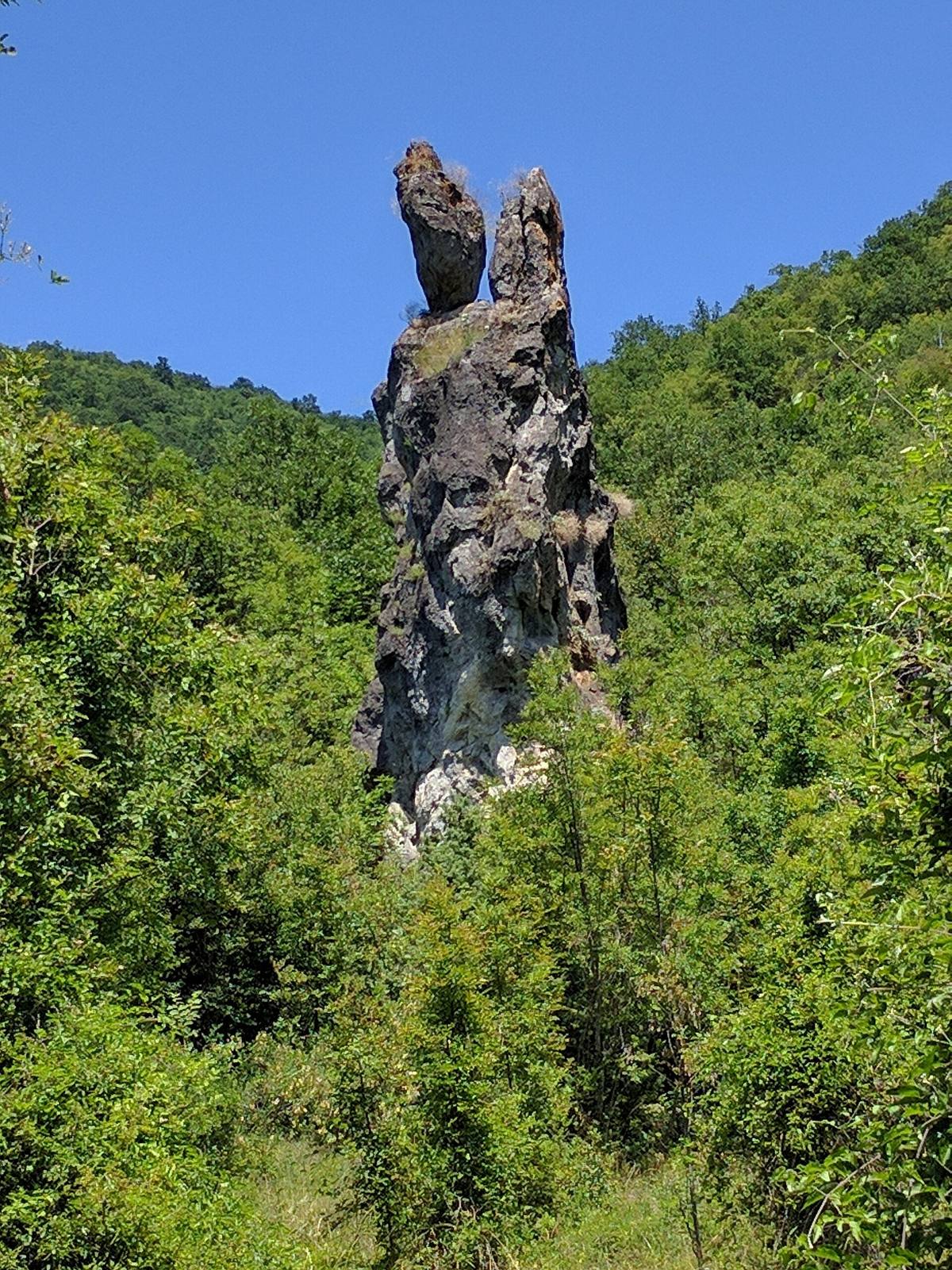
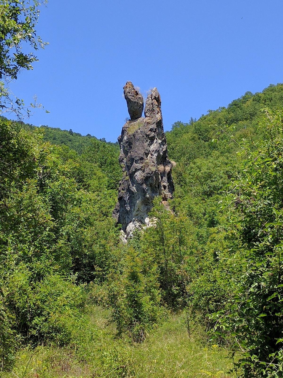
↗The article records the names Samotniko, Tutunyarniko, Shegava Ritli, the Camels, and the Turtle. Samotniko is also called Rashova Rock. Tutunyarniko is linked with former tobacco fields. These names show how people recognize animals, objects, and local activities in the stone outlines.
Caves also have local names: Galabarniko, Belovashtitsa, and Dren Dupka. The authors describe a high rock niche known as the “Eye of Shegava,” explicitly noting its difficult access. It is not a suitable destination for an unprepared walk. No exact total number of caves was established, and the frequently repeated figure of “over 20” is not reproduced here.
Tales around the entrance
↗Ivanov and Todorov record a legend connecting the stone figures with petrified soldiers from the Battle of Velbazhd. Another local story explains Razhdavitsa’s name through villagers refusing the king assistance and receiving a curse. These are folk explanations of the landscape and village name. They establish neither the battle’s precise location nor the name’s actual origin.
Nature and conservation
↗In 2021, the Association of Parks in Bulgaria proposed a protected locality following an initiative by Ivanov and Todorov. The proposal includes rock formations and habitats of orchids, reptiles, and invertebrates. Listed plants include violet limodore and pyramidal orchid, while the animals include Hermann’s tortoise. This describes the reasons for conservation, rather than promising that every visitor will see these species.
A proposal and a designation order are different documents. Our check did not establish a final administrative act designating this particular protected locality. The proposed 304.4 ha are therefore not presented as an officially designated area.
Walking
↗The described approach begins at the karst spring on the road from Razhdavitsa toward Garbino. The map pin marks this starting point. Allow around three hours for a mountain walk, depending on the section you choose. Arrange a route with a local guide for the high steps and niches. After heavy rain or during snowmelt, do not treat dry summer photographs as evidence that the riverbed is passable.
Photos and related images
The image could not load. Its caption and source remain available.

The image could not load. Its caption and source remain available.

The image could not load. Its caption and source remain available.

Sources
(3)
A date may refer to construction, renewal, or another stated stage. Legends are accounts recorded in sources, rather than established events. Bibliography links help locate the named author; no automatic reference is added where the match is ambiguous.
- Атанас Иванов, Станислав Тодоров. Скални феномени и защитени видове в каньона на река Шегава, Географ, бр. 8, 2023-2024, 141-148PDF document · Bulgarian · geograf.bg
Source address
https://geograf.bg/sites/default/files/emagazine/emagazine2024.pdf
If a link does not open, use its title, author, and address to search, or consult another listed source.
- Асоциация на парковете в България. Предложение за защитена местност „Каньона на река Шегава“, 2021PDF document · Bulgarian · priroda.parks.bg
Source address
https://priroda.parks.bg/wp-content/uploads/2021/07/Predlozhenie-ZM-Kanyona-na-reka-Shegava.pdf
If a link does not open, use its title, author, and address to search, or consult another listed source.
- OpenStreetMap: node/11423912013Map record · Language not specified · openstreetmap.org
Source address
https://www.openstreetmap.org/node/11423912013
If a link does not open, use its title, author, and address to search, or consult another listed source.