94History · Skaleto locality, near Pastuh
Gradishteto near Pastuh
Medieval remains; historical identification disputed
Your visit at a glance
- Address
- Fortress hill at Skaleto, east of Pastuh
- Suggested time; scope not confirmed
- Not yet reviewed
- Visiting conditions
- No verified information found
- Admission
- No verified information found
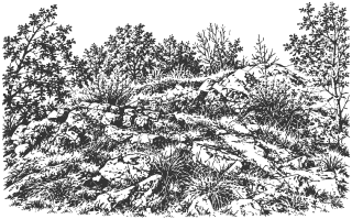
The fortress hill at Skaleto near Pastuh is often called Zhitomisk. That historical identification is a hypothesis and should be distinguished from the visible remains themselves.
Hours, admission, and directions ↓
Above the Struma’s meanders near Pastuh, the rocky hills of Skaleto preserve fortress remains and a ruined church. Accounts of the area frequently use the name Zhitomisk. Visitors should distinguish Gradishteto itself from its disputed identification with a town known from medieval sources.
How the identification developed
↗In the Dupnitsa chapter of Travels in Bulgaria, on pages 607-609 of the available scanned excerpt, K. Irechek describes old fortress foundations and church walls opposite Pastuh. He then proposes ideas about the area’s former political importance and mentions Zhitomitsk. His presentation is conjectural; it is not an excavation report establishing the location.
Later tourism texts use Zhitomisk as an established name and add stories about Justinian or a grain market. Such claims are not accepted here as demonstrated history of this particular hill. The municipal historical overview refers more cautiously to a fortress at Skaleto near Pastuh.
The hills and church
↗Blagovest Petrov’s walking account from February 2022 describes two tops at Gradishteto connected by a natural stone threshold. The Sveti Mesta catalog also distinguishes a southern fortified hill and the ruins of the Mother of God church by the northern one. The walls, church, and entire supposed former settlement are not a single point. [4]
The church is separate from Holy Trinity at Pastuh, which the described approach passes. Dates from one should not be transferred to the other or to every fortification. A sufficiently reliable separate construction chronology for the fortress complex has not been established.
Preparing for the walk
↗Petrov describes a steep ascent, overgrown stretches, and traces of markings. This records a past visit, rather than confirming a maintained route today. The rocky slopes above the river require a careful choice of approach.
The map uses the fortress coordinates published by Bulgarian Castles, about 60 m from the supplied Google Maps point. This is a reference for the remains, rather than a checked entrance or parking place. Petrov separately records the walking approach start at 42.208444, 22.918500; these coordinates come from his 2022 outing and do not confirm the trail’s present condition. No ascent time is promised. Assignment to Nevestino Municipality is supported by the municipal overview and mapped boundary; nearby Skrino does not automatically determine the site’s administrative location.
Sources
(7)
A date may refer to construction, renewal, or another stated stage. Legends are accounts recorded in sources, rather than established events. Bibliography links help locate the named author; no automatic reference is added where the match is ambiguous.
- Google Maps: Градището край ПастухOnline source · Bulgarian · maps.app.goo.gl
Source address
https://maps.app.goo.gl/Pm3T4yJvEcF1ieF59
If a link does not open, use its title, author, and address to search, or consult another listed source.
- К. Иречек. Пътувания по България, глава III.6 „Дупница“, сканиран откъс, с. 607-609; изданието и годината не са установени от откъсаPDF document · Bulgarian · a.storyblok.com
Source address
https://a.storyblok.com/f/214561/x/7d3449b28f/konstantin_irechek_za_dupnitza_i_okoliata.pdf
If a link does not open, use its title, author, and address to search, or consult another listed source.
- Община Невестино. История, крепостта в м. Скалето при ПастухOnline source · Bulgarian · nevestino.bg
Source address
https://nevestino.bg/municipality/history
If a link does not open, use its title, author, and address to search, or consult another listed source.
- Благовест Петров. Тайните на Пастух, „Разходки за ден ... или два!“, 04.02.2022Online source · Bulgarian · razhodkizadenilidva.blogspot.com↑1
Source address
https://razhodkizadenilidva.blogspot.com/2022/02/blog-post.html
If a link does not open, use its title, author, and address to search, or consult another listed source.
- Свети места. „Св. Богородица“, с. Пастух, описание на крепостния хълм и църкватаOnline source · Bulgarian · svetimesta.com
Source address
https://www.svetimesta.com/svetimesta.com/Средновековни-църкви/Св.%20Богородица-%20с.%20Пастух
If a link does not open, use its title, author, and address to search, or consult another listed source.
- OpenStreetMap: община Невестино, relation/1978252, граница за ориентировъчна административна проверкаMap record · Bulgarian · openstreetmap.org
Source address
https://www.openstreetmap.org/relation/1978252
If a link does not open, use its title, author, and address to search, or consult another listed source.
- Български крепости. С. Пастух, крепост Житомистк, публикувани GPS координатиOnline source · Bulgarian · bulgariancastles.com
Source address
https://www.bulgariancastles.com/s-pastuh-krepost-zhitomistk/
If a link does not open, use its title, author, and address to search, or consult another listed source.