78Places of worship · Pastuh
Holy Trinity Church
16th-17th century
Dating stated in the sources: 16th-17th century (dating)
Your visit at a glance
- Address
- Eastern Pastuh, on the left bank of the Struma
- Suggested time; scope not confirmed
- about 30 minutes
- Opening hours
- No verified information found
- Admission
- No verified information found
The image could not load. Its caption and source remain available.

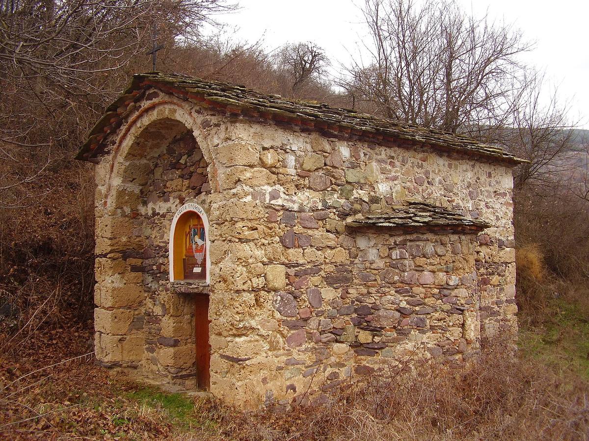
Holy Trinity is a small late medieval church on the Struma’s left bank at Pastuh. Its three-conch plan and wall-painting fragments recorded in older photographs distinguish it from the area’s other churches.
Hours, admission, and directions ↓
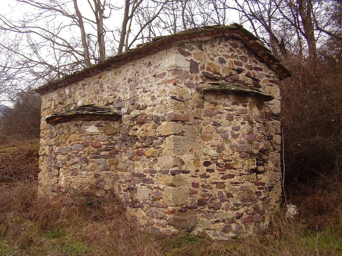
In eastern Pastuh, on the Struma’s left bank, Holy Trinity is a low stone church whose plan becomes clear on a walk around the exterior. Its exterior is modest, but the plan includes three rounded sections. This is a separate building from the village’s other churches; their historical descriptions should not be mixed with its own.
A small church with three conches
↗Dupnitsa Municipality’s cultural catalog under project CB006.2.21.150 dates construction to the 16th-17th century. It describes a single-nave church with one altar apse and a three-conch plan. A conch is a rounded recess: here the eastern apse and lateral extensions create the building’s characteristic outline.
The same catalog describes a barrel vault and a floor sunk two steps below ground level. The walls are built of rubble stone in mortar; tufa was used for particular architectural elements and the niche above the entrance. These material differences help explain the small building’s construction, but do not independently establish the date of a repair.
Traces of painting
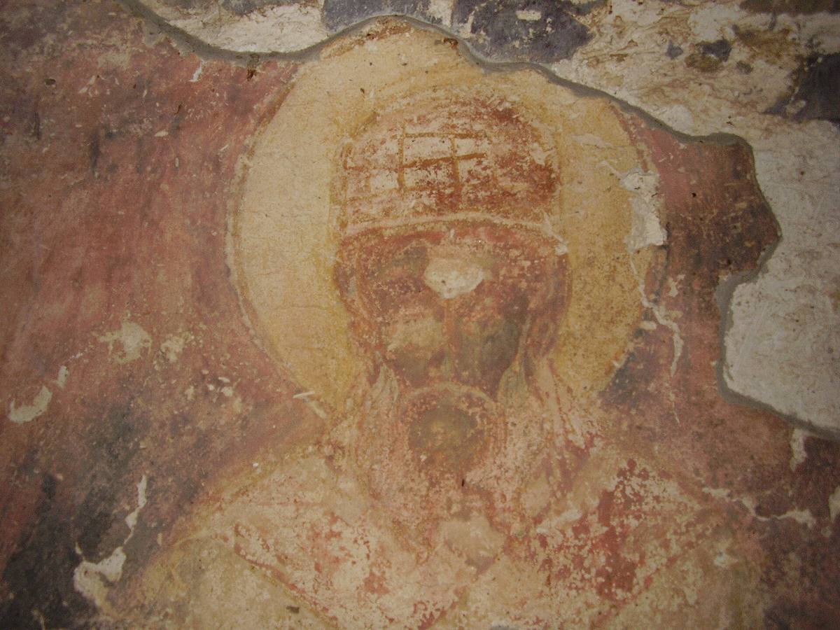
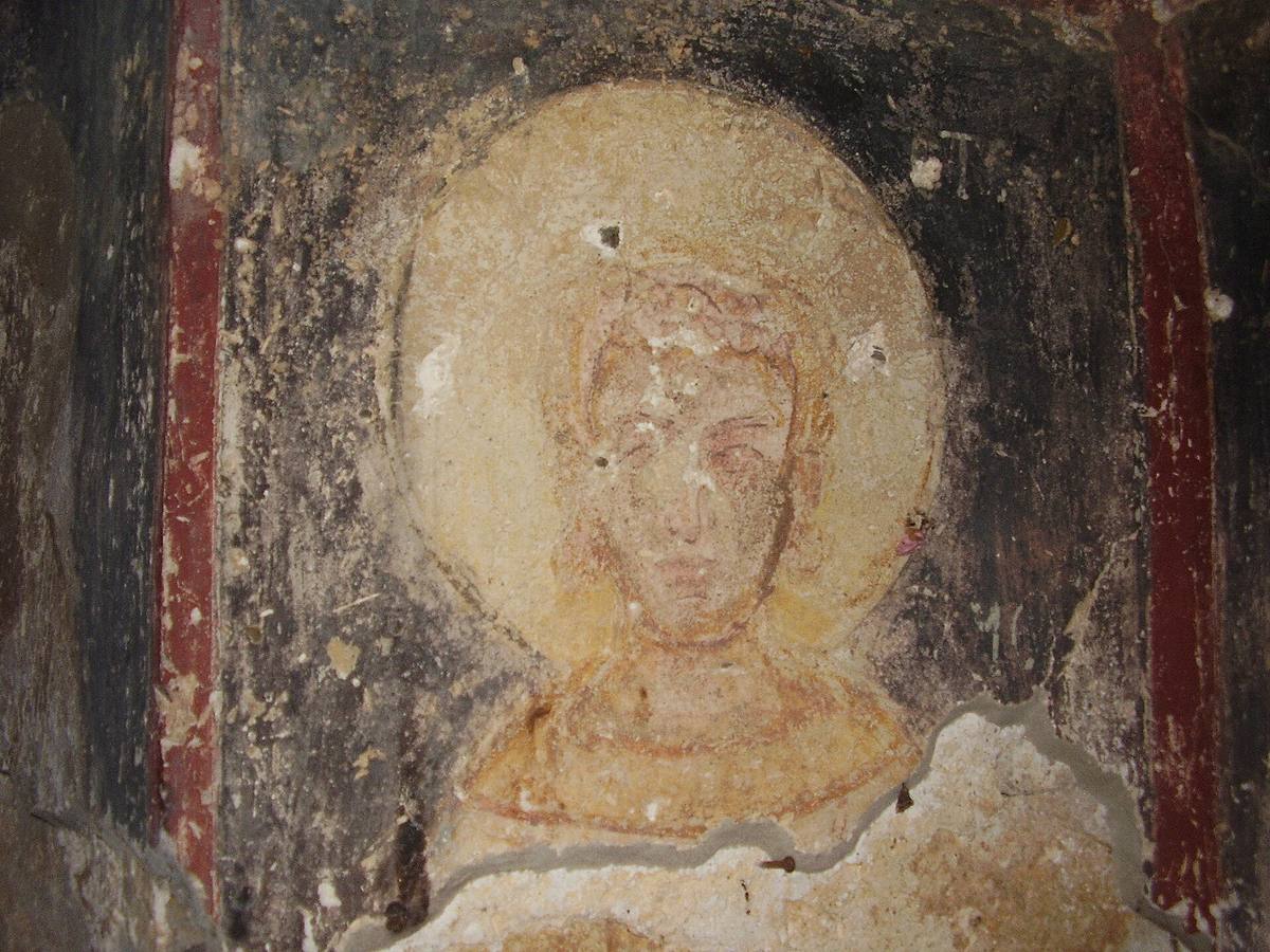
↗The catalog states that the interior was once entirely painted and that fragments survive. The selected freely licensed photographs from 2008 show parts of faces and halos within damaged painted fields. Their condition is a historical record, not a promise of what a visitor can see today.
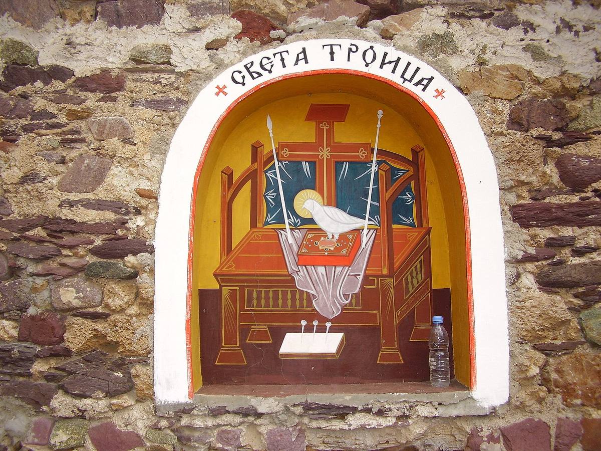
Hypothesis or unconfirmed claim The painter’s identity and the dates of each surviving painted layer have not been confirmed. The exterior icon above the entrance should not automatically be dated together with the medieval wall paintings either. The building, older fragments, and later images require separate consideration.
Along the Struma
↗The church appears in Dupnitsa Municipality’s published cultural routes alongside St. Petka in Vukovo and Kadin Bridge. Such a trip allows visitors to compare monuments of different dates and functions. Allow about half an hour to see Holy Trinity alone if the church can be opened.
Ask locally who holds the key and whether entry is possible. No verified visitor schedule or admission tariff was found. The map marker follows the building identified by this name in OpenStreetMap. If the interior is inaccessible, an exterior visit still reveals the stonework and three rounded sections.
Photos and related images
The image could not load. Its caption and source remain available.

The image could not load. Its caption and source remain available.

The image could not load. Its caption and source remain available.

The image could not load. Its caption and source remain available.

Sources
(3)
A date may refer to construction, renewal, or another stated stage. Legends are accounts recorded in sources, rather than established events. Bibliography links help locate the named author; no automatic reference is added where the match is ambiguous.
- Община Дупница, проект CB006.2.21.150. Църква „Света Троица“, с. ПастухOnline source · Bulgarian · dupnicaclocktower.eu
Source address
https://dupnicaclocktower.eu/църква-света-троица-с-пастух/
If a link does not open, use its title, author, and address to search, or consult another listed source.
- Община Дупница. Културни маршрути, проект CB006.2.21.150Online source · Bulgarian · dupnicaclocktower.eu
Source address
https://www.dupnicaclocktower.eu/cbcroute/
If a link does not open, use its title, author, and address to search, or consult another listed source.
- OpenStreetMap: way/421680460Map record · Language not specified · openstreetmap.org
Source address
https://www.openstreetmap.org/way/421680460
If a link does not open, use its title, author, and address to search, or consult another listed source.