60History · Dupnitsa
Clock Tower
Late 18th century; initial construction in 1782 according to the municipality
Dating stated in the sources: 1790-1800, conversion for a clock
Your visit at a glance
- Address
- Town Garden, Dupnitsa
- Suggested time; scope not confirmed
- about 30 minutes
- Opening hours
- No verified information found
- Admission
- No verified information found
The image could not load. Its caption and source remain available.

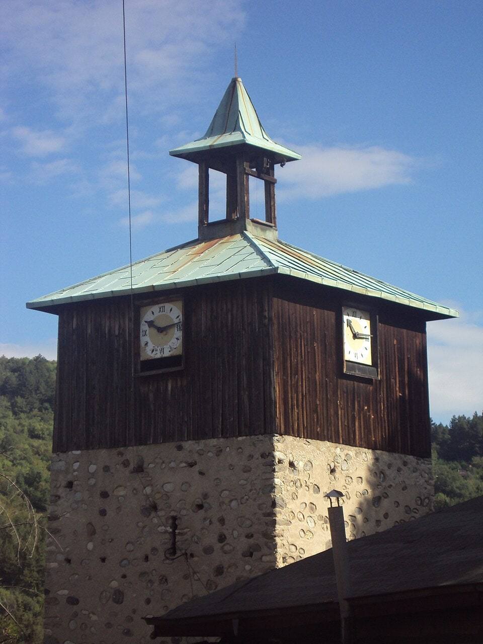
The Clock Tower stands in Dupnitsa’s Town Garden above the center. Originally a defensive tower, it was adapted for a clock in the late 18th century. Its stone base, wooden level housing the clock, and pointed roof create a recognizable silhouette.
Hours, admission, and directions ↓
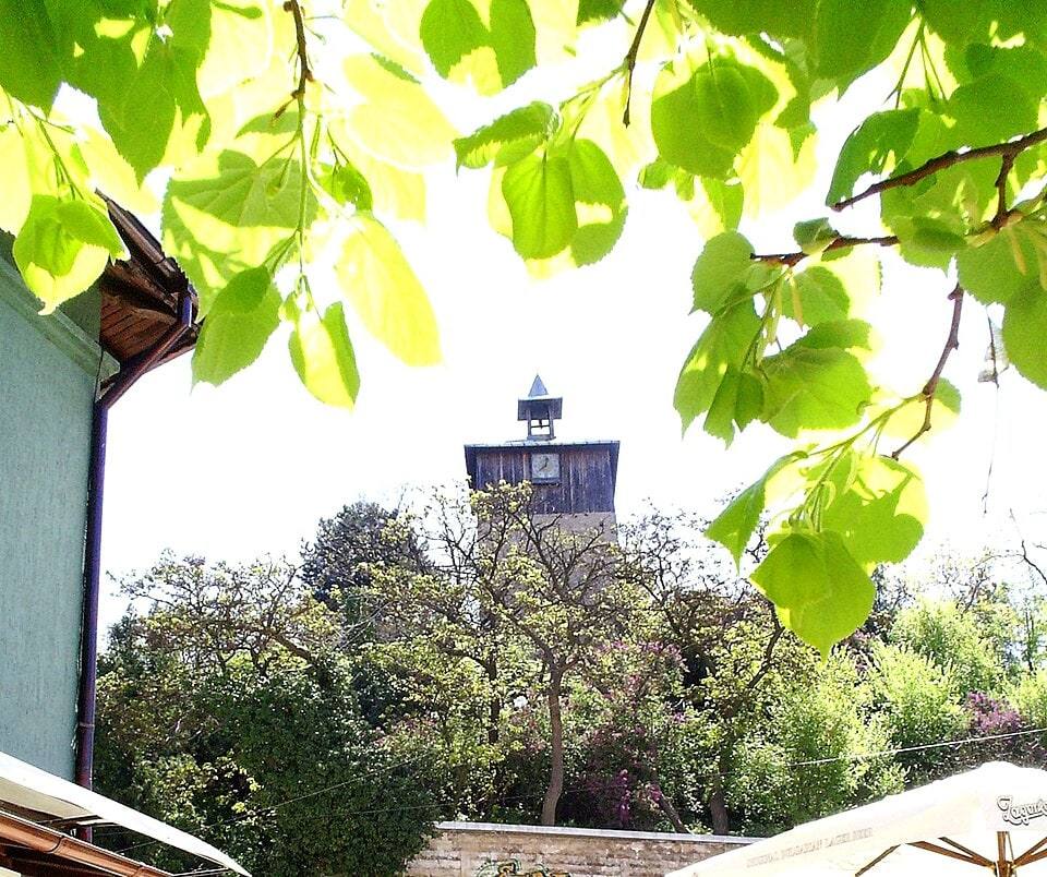
From the lower street, the tower appears above the greenery. During the ascent, the stone lower volume gradually emerges while the dials remain high above the pedestrian. The setting combines a building, a town garden, and views toward surrounding roofs.
From defense to timekeeping
↗Dupnitsa Municipality maintains a dedicated tower page through an Interreg Bulgaria-North Macedonia project. It gives a construction date of 1782 for a bey’s defensive tower with four embrasures, known as mazgali.
The same source places conversion to a clock tower in 1790-1800. The change in purpose matters: walls and openings served defense, while the elevated dials and bell later marked time for the town.
The Bulgarian encyclopedic account also gives a range of 1792-1813. This does not fully coincide with the municipal construction date. Here, 1782 is explicitly attributed to the municipality, while the general period is the late 18th century.
Stone, timber, and four dials
↗The municipality gives a height of 17.2 m and a side measuring approximately 5.5 m. The lower volume is stone. Above it stands a wooden section carrying the clocks, capped by a pointed metal roof. These materials read as successive levels from outside.
In the older photographs, the stone is pale and the wooden panels dark. Four dials make the clock visible from different directions. The small open volume beneath the upper roof and broad overhang complete the silhouette.
Visitors can compare the defensive mass with the lighter clock superstructure from the garden paths. A permanent museum operation with open interior floors was not established.
Mechanism and bell
↗The municipal account associates the old mechanism with local craftspeople and records its stopping in 1939. It notes restoration of the tower and clock in 1979. The newer project includes structural strengthening, work on stone facades and timber fabric, and installation of a new mechanism and four dials.
Accounts of the bell differ. The project page reports Vienna and 1782, while the encyclopedic entry relays an inscription dated 1792 dedicating it to a St. Demetrius church. Without direct inspection and reading of the inscription, neither version is presented as resolving the disagreement conclusively.
The bell and building are separate pieces of historical evidence. Even a certain bell date would not, by itself, establish the precise construction year of every part of the tower.
Town Garden and approach
↗The tower stands in the Town Garden near the center. The municipal page describes stone steps from the main street, past the Yatachkata monument and memorial plaques to Jewish soldiers. Paths and benches surround the tower.
Hypothesis or unconfirmed claim Allow approximately half an hour for a short ascent and observation. The steps mean this described approach is not step-free. If you need an easier route, establish possible garden entrances locally. Specific interior accessibility was not confirmed.
No operator visiting hours or admission tariff were established. The gallery contains older views, rather than confirming conditions after the latest work. The walk can be combined with other places in central Dupnitsa, while Dyakovo Reservoir requires separate travel outside town.
Photos and related images
The image could not load. Its caption and source remain available.

Sources
(3)
A date may refer to construction, renewal, or another stated stage. Legends are accounts recorded in sources, rather than established events. Bibliography links help locate the named author; no automatic reference is added where the match is ambiguous.
- Часовниковата кула в Дупница, Община Дупница, проект Interreg България-Северна МакедонияOnline source · Bulgarian · dupnicaclocktower.eu
Source address
https://dupnicaclocktower.eu/clocktower/
If a link does not open, use its title, author, and address to search, or consult another listed source.
- Часовникова кула (Дупница), УикипедияEncyclopedia article · Bulgarian · bg.wikipedia.org
Source address
https://bg.wikipedia.org/wiki/Часовникова_кула_(Дупница)
If a link does not open, use its title, author, and address to search, or consult another listed source.
- OpenStreetMap: way/810032379Map record · Language not specified · openstreetmap.org
Source address
https://www.openstreetmap.org/way/810032379
If a link does not open, use its title, author, and address to search, or consult another listed source.