55Nature and parks · Ovchartsi
Goritsa Waterfall
Your visit at a glance
- Address
- Above Ovchartsi, Rila’s northern foothills
- Suggested time; scope not confirmed
- about 1 hour
- Visiting conditions
- No verified information found
- Admission
- No verified information found
The image could not load. Its caption and source remain available.

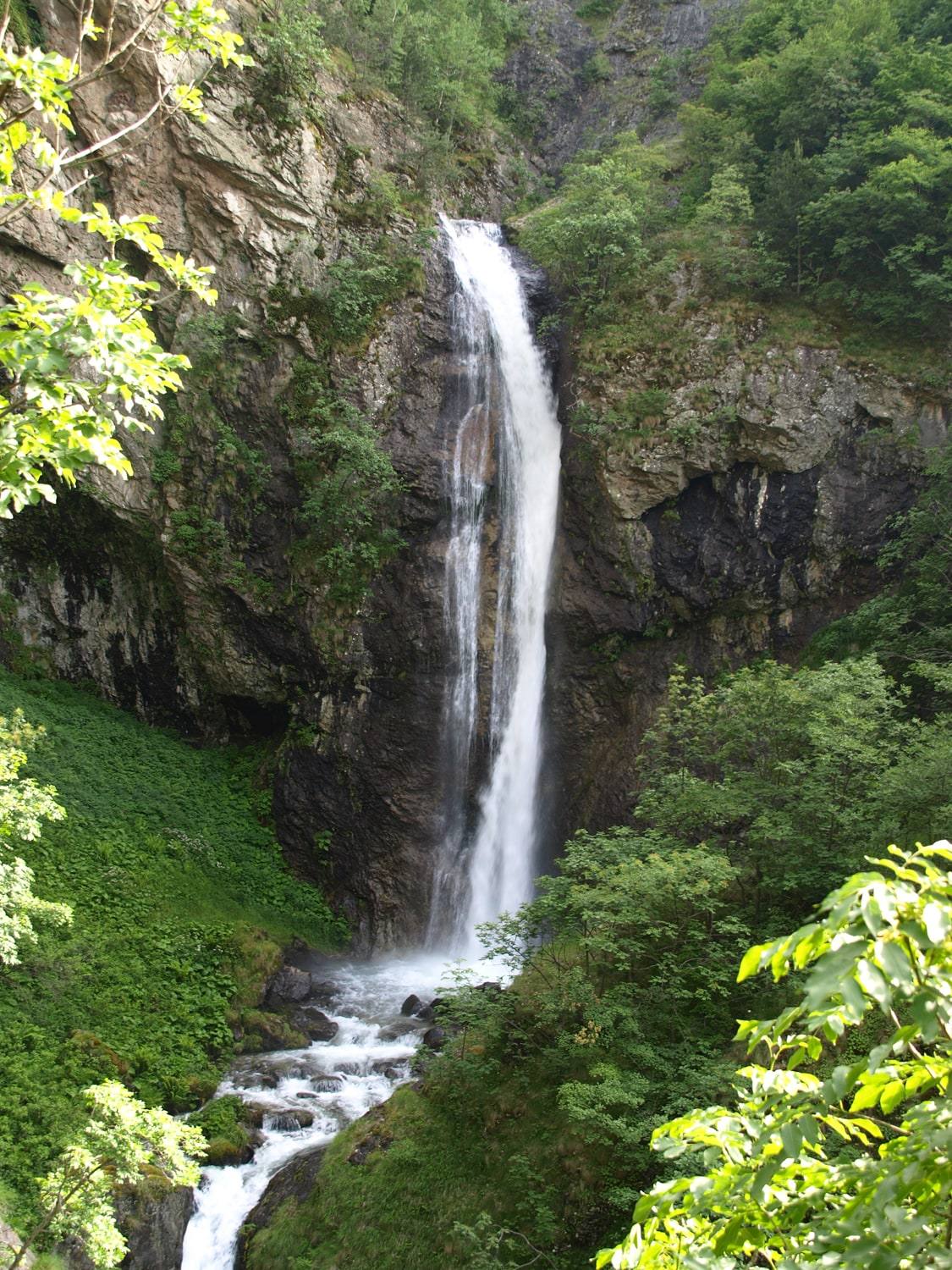
Goritsa Waterfall lies above Ovchartsi, in Rila’s northern foothills. The municipality gives the fall’s height as 39 m and dates its designation as a natural monument to 1965. A forest approach leads toward a rock threshold viewed from the trail and observation area.
Hours, admission, and directions ↓
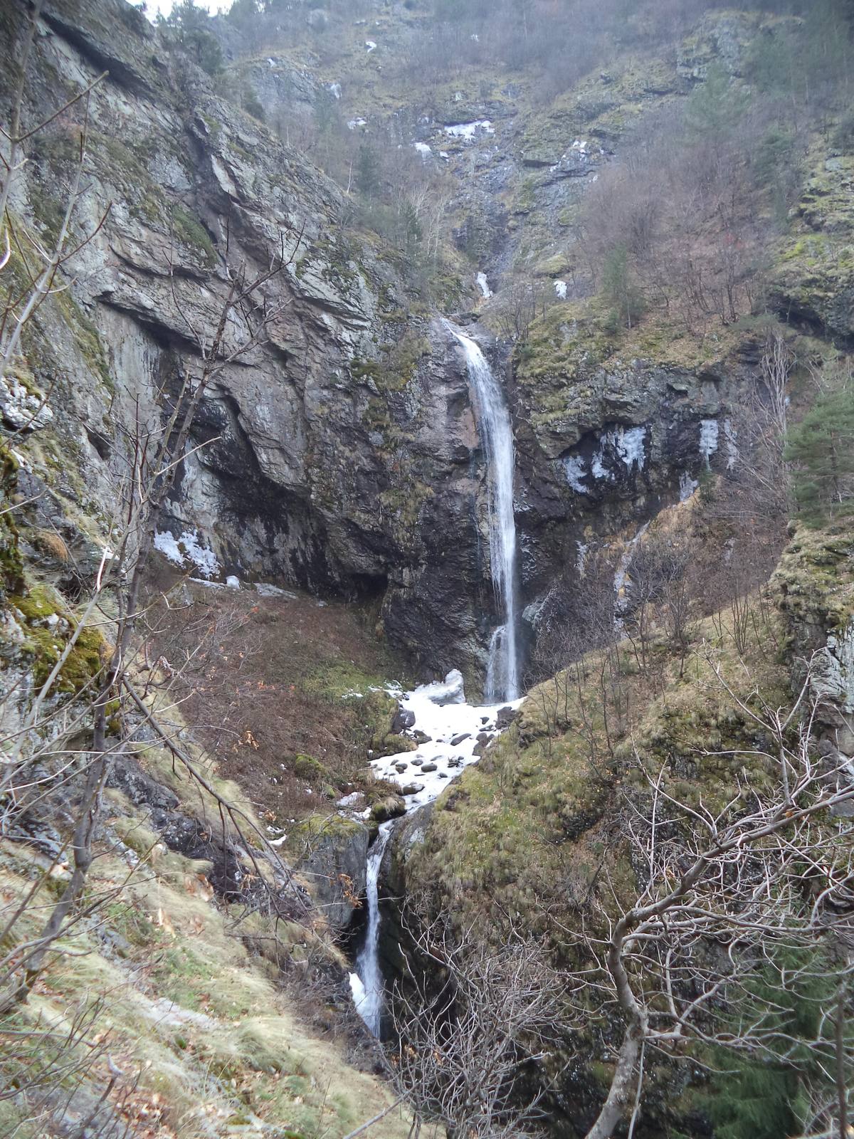
Between the rocks, water gathers into a narrow, pale column. In the green months, trees conceal parts of the slopes; in winter, the surrounding terrain is more exposed. Photographs from different seasons show how vegetation changes the view of the same place.
River and waterfall
↗The Goritsa descends from Rila’s northern slopes toward Ovchartsi and the Dzherman River. The municipality’s tourism account describes the seven Ovchartsi waterfalls as a group along the river. This walk’s main destination is the tall Goritsa Waterfall, at approximately 900 m above sea level.
The stated 39 m concern this landmark’s water drop. Seven refers to separate waterfalls along the river, rather than seven steps within one 39 m waterfall. The wider winter photograph shows successive upper and lower drops separated by rock.
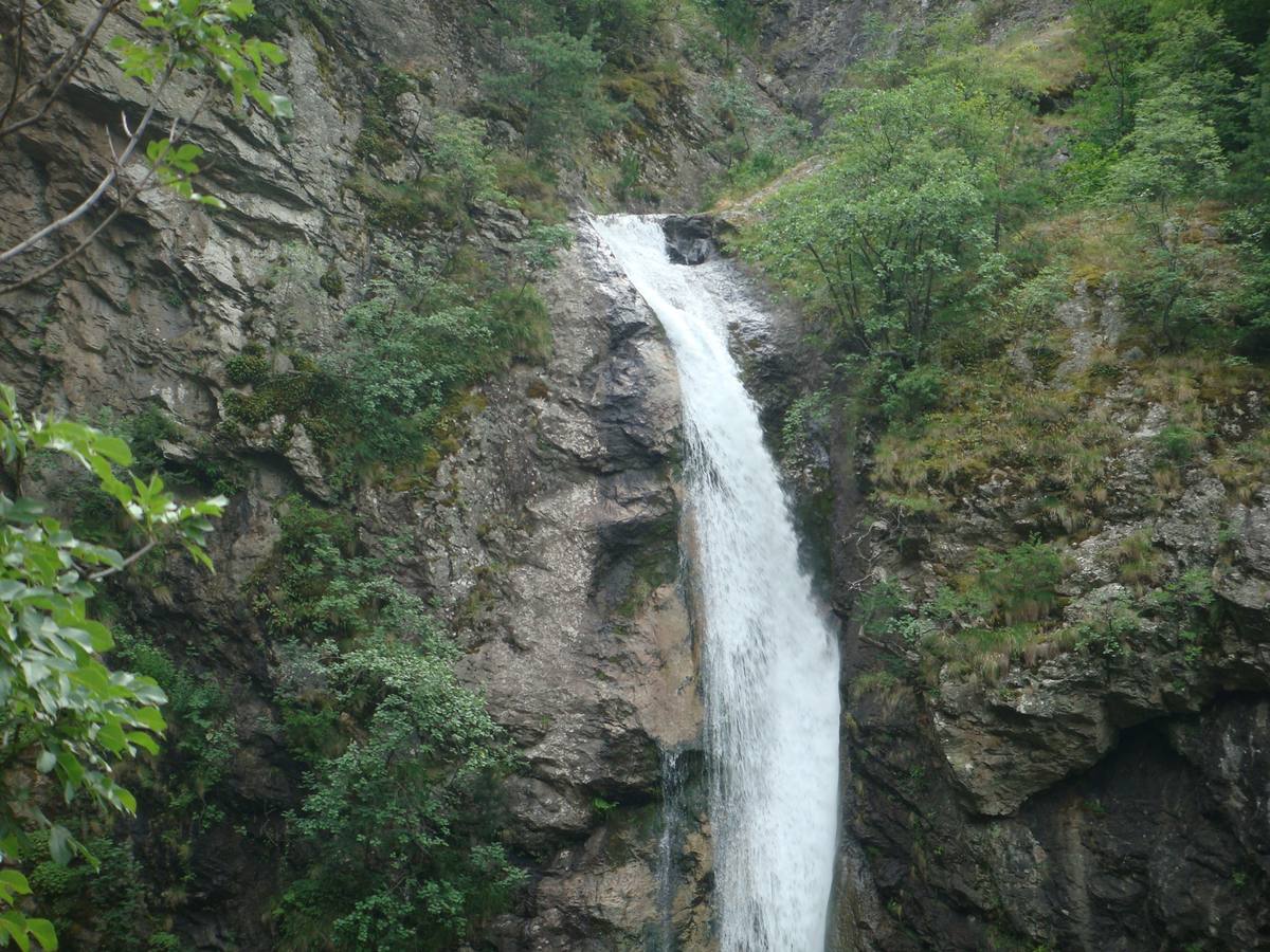
From the trail, look for a viewpoint that reveals the whole visible threshold. A closer photograph emphasizes the water and nearly vertical face; a wider view shows the valley’s gradient. A photograph of flowing water records a particular day, rather than a constant flow throughout every season.
Natural monument
↗Sapareva Banya Municipality dates the waterfall’s protection to 1965.
The protected site comprises a natural formation and its surroundings. Use the established visitor approach. Rocks and riverbanks should be left undisturbed, without collecting stones, damaging plants, or making shortcuts toward the water.
Signs and barriers on site determine how far visitors may go. A trail or observation-area closure takes precedence over an older route found online. The archival gallery photographs do not establish the facilities’ current condition.
The legend of Goritsa
↗Tradition or legend The municipal account connects the name with a young woman, Goritsa, and her beloved, the shepherd Yovitsa. A local Ottoman bey heard of her beauty and sent men to abduct her. According to the legend, she fled into the mountains and jumped from the rocks to escape her pursuers.
This is a local legend explaining the waterfall’s name. No historical date or documentary evidence is supplied for the event. The story belongs to the place’s remembered tradition, while the height, river, and rock face describe the natural site itself.
Approach from Ovchartsi
↗Start from Ovchartsi and follow the signs for the waterfall, continuing on foot along the forest trail. Allow about an hour for the walk and stop, longer at a slower pace. Establish the route’s starting point and the observation area’s current condition locally.
Hypothesis or unconfirmed claim Steps, uneven ground, and possible dampness call for shoes with good grip. Stay behind barriers and do not descend the wet rocks toward the waterfall’s foot. Step-free access has not been confirmed. No operator source established visiting hours or an admission price.
After returning, the outing can continue at Sapareva Banya’s geyser. The forest waterfall and town thermal fountain are separate stops, with different viewing conditions.
Photos and related images
The image could not load. Its caption and source remain available.

The image could not load. Its caption and source remain available.

Sources
(3)
A date may refer to construction, renewal, or another stated stage. Legends are accounts recorded in sources, rather than established events. Bibliography links help locate the named author; no automatic reference is added where the match is ambiguous.
- Овчарченски водопад „Горица“, Община Сапарева баня, 28.11.2019Online source · Bulgarian · saparevabanya.bg
Source address
https://saparevabanya.bg/pages/pid/957/Туризъм/Забележителности/Овчарченски-водопад-„Горица”.html
If a link does not open, use its title, author, and address to search, or consult another listed source.
- Горица (река), УикипедияEncyclopedia article · Bulgarian · bg.wikipedia.org
Source address
https://bg.wikipedia.org/wiki/Горица_(река)
If a link does not open, use its title, author, and address to search, or consult another listed source.
- OpenStreetMap: node/9726437462Map record · Language not specified · openstreetmap.org
Source address
https://www.openstreetmap.org/node/9726437462
If a link does not open, use its title, author, and address to search, or consult another listed source.