76Nature and parks · Ruen section of Vlahina
Boboshevski Ruen Peak
Your visit at a glance
- Address
- Ridge above Skrino and the two monasteries, near the Kocherinovo municipal boundary
- Approximate time for the whole walking outing
- about 2 hours 30 minutes
- Visiting conditions
- No verified information found
- Admission
- No verified information found
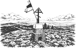
Boboshevski Ruen is a 1,134 m summit in the Ruen section of Vlahina. Approaches of different lengths start at Ruen Monastery and Boboshevo Monastery.
Hours, admission, and directions ↓
Boboshevski Ruen rises above the Struma Valley and connects with the paths between Skrino and Boboshevo. Its elevation is 1,134 m according to the named OpenStreetMap summit and Pateka’s field account. It is different from Ruen in Osogovo, which reaches 2,251 m. The shared name does not imply the same route or climbing conditions.
Ridge and views
↗Pateka places the summit in the Ruen section of Vlahina and describes views toward Rila, Pirin, Vitosha, and neighboring mountains in clear weather. Part of the approach passes through woodland before reaching open ground higher up. This combination differs from Osogovo’s long exposed ridge.
The summit is immediately beside the boundary between Boboshevo and Kocherinovo Municipalities. The approaches described below start at the two monasteries in Boboshevo Municipality. When selecting a starting point, distinguish Ruen Monastery above Skrino from Boboshevo’s St. Demetrius Monastery.
From Ruen Monastery
↗The shorter approach starts at Ruen Monastery above Skrino. Pateka gives about 45 minutes uphill and approximately 260 m of ascent. The route initially follows directions toward the cross and cave, then branches onto the summit path. The account records red painted waymarks in spring 2026.
The cave of St. John of Rila near the monastery and the summit are separate places. The hermit tradition belongs to the monastery’s story and does not date a summit building or establish an ancient sanctuary. Visiting the nearby sights adds time to the ascent.
The longer approach
↗From Boboshevo Monastery, the same field source gives about an hour and 45 minutes uphill, with approximately 380 m of ascent. This approach uses a dirt road and the ridge. The account describes it as unmarked.
A circuit connecting the two monasteries needs greater care: Pateka reports an overgrown section between them where the path disappears in places. Do not plan the return merely on the impression that the summit is close. Allow about two and a half hours for the shorter approach and return, and longer for the other option. Carry water and check weather and paths locally.
Sources
(4)
A date may refer to construction, renewal, or another stated stage. Legends are accounts recorded in sources, rather than established events. Bibliography links help locate the named author; no automatic reference is added where the match is ambiguous.
- Пътека. Връх Бобошевски Руен от Руенския манастир и от Бобошевския манастир, теренни маршрути, актуализация за пролетта на 2026 г.Online source · Bulgarian · pateka.im
Source address
https://pateka.im/boboshevski-ruen/
If a link does not open, use its title, author, and address to search, or consult another listed source.
- OpenStreetMap: node/11373726139, Бобошевски РуенMap record · Bulgarian · openstreetmap.org
Source address
https://www.openstreetmap.org/node/11373726139
If a link does not open, use its title, author, and address to search, or consult another listed source.
- OpenStreetMap: общинска граница Бобошево, relation/1978247Map record · Bulgarian · openstreetmap.org
Source address
https://www.openstreetmap.org/relation/1978247
If a link does not open, use its title, author, and address to search, or consult another listed source.
- OpenStreetMap: общинска граница Кочериново, relation/1978250Map record · Bulgarian · openstreetmap.org
Source address
https://www.openstreetmap.org/relation/1978250
If a link does not open, use its title, author, and address to search, or consult another listed source.